With the passing of each individual a story or photo falls silent
HELP SAVE OUR HISTORY
  • Our Goal ~ Contribute
  • Research Resources
  • Area History
    • Residents with Military Service
    • Red River Ferries & Fords >
      • Oscar Ferry
      • Grady Ferry
      • Petersburg Ferry
      • Courtney Ferry
  • Photo Contributions
Period Maps of Courtney Flats Area
Appreciation to Map Gallery, Edmond Low Library, OSU
please report broken links
Indian Territory
1879
Indian Territory
1887
Chickasaw Nation
1895
Indian Territory
1898

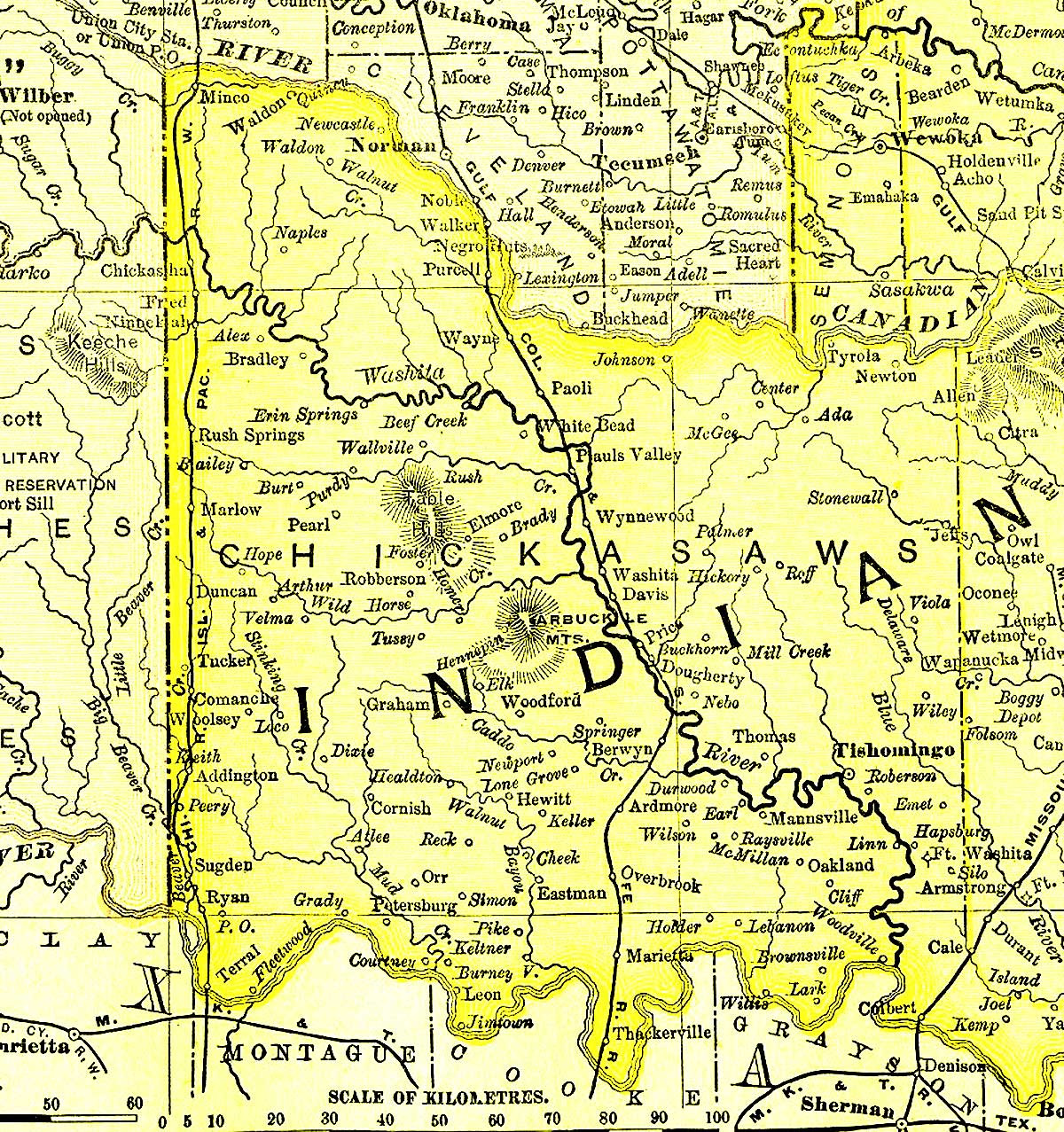
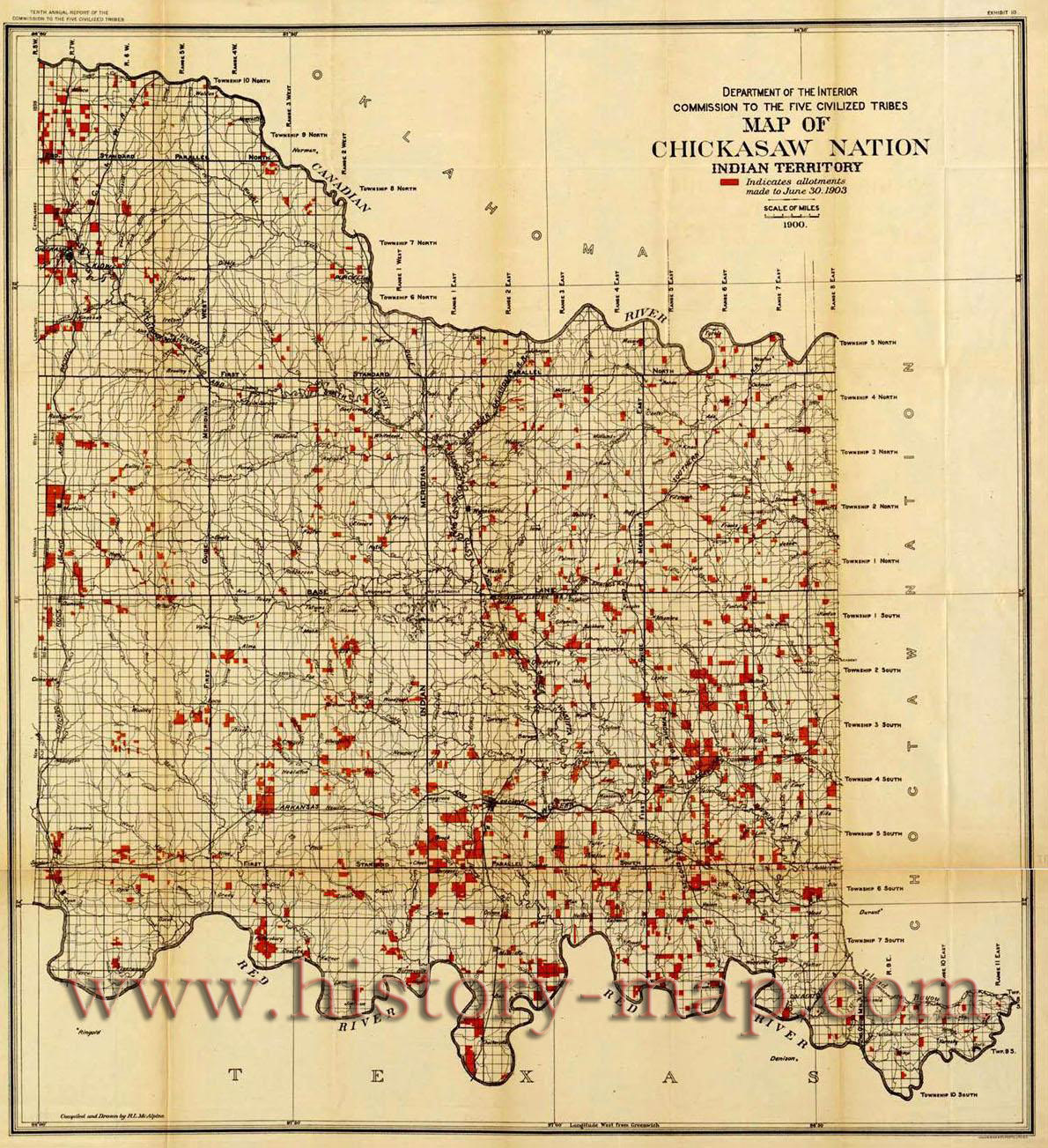
The roadways have changed from the 1898 map and the 1900 map below.
Chickasaw Nation
1900
Chickasaw Nation
Allotments 1903
Chickasaw Nation
Allotments 1904
The 1900 Chickasaw Nation map reflects the local towns and roadways atop the survey grid. The next
two maps utilizes the same 1900 map backdrop with the addition of land allotments by 1903 and 1904.
Addington Quad 1901 Edition
Reflecting Grady & Orr
Gainesville Quad 1902 Edition
Reflecting Courtney & Illinois Bend
 
Montague Quad. 1905 Edition
Reflecting Petersburg & Spanish Ft

State of Sequoyah
"proposed" 1905

State of Oklahoma
"proposed" 1906
Jefferson County, OK
1915
1940 Census Enumeration Dist.
Jefferson Co., OK

1940 Census Enumeration Dist.
Love Co., OK
1940 Census Enumeration Dist.
Montague Co., TX
Jefferson Co., OK
T7S R4W
Love Co., OK
T7S R 3W


Back to Research Resources